

We are off to hike the Haute Route, the third of our three Alpine hikes, the others being the Tour du Mont Blanc and the Dolomites.
The Haute Route (or the High Route or Mountaineers' Route) is the hiking and ski-touring route from Chamonix to Zermatt. Not that there is a single route. The Alps are well-covered with hiking paths so there are choices to be made as to exactly which path to take and where to stay each night.
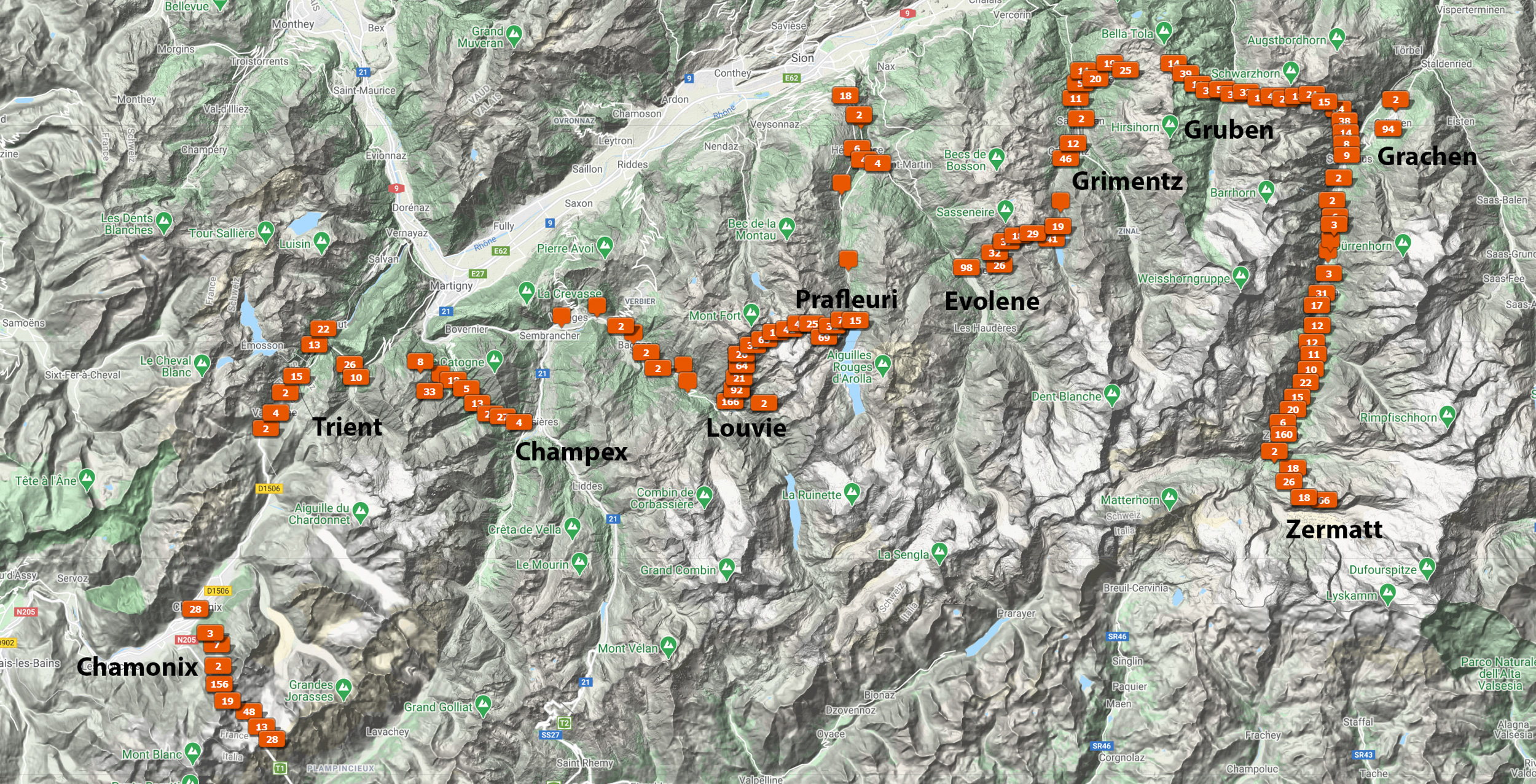
This map shows where we went. It uses the gps coordinates from the photos I took along the way. We began on the lower left, in Chamonix, and ended up on the lower right, in Zermatt. It took ten days though that included a day off, half-way through, in Evolene. The hike packed in a diverse selection of mountain scenery, pretty Swiss villages, and comfortable accommodations, and it was capped off with a visit to charming, car-free Zermatt.
An attractive feature of this hike is that most of the over night stays—Louvie and Prafleuri aside—are accessible by transit, so you can take a hiking break yet keep on schedule. This option proved useful.
Four of us started the hike though only two completed it. We made reservations for all hotels and huts. We hiked in August because by then most of the snow is gone. A benefit was seeing the spring flowers. It was cool and often damp so we carried rain coats and pack covers and we made use of them. We carried everything ourselves, in other words we used no travel assistants, though since we weren't camping we did not need to carry tents, sleeping bags, and cooking supplies.
To follow along, press the link in the upper right corner of this post.